Canal Basin Park: 20 acres of urban green space in the heart of the Flats
Earlier today, Tim Donovan, executive director of Canalway Partners, George Cantor, staff planner of Cleveland's Planning Commission and Jeff Kerr of Environmental Design Group presented an ambitious schematic plan development for the future Canal Basin Park to the city's Planning Commission members, who unanimously approved it.
The document outlines plans for 20 acres of underutilized urban property in the central part of the Flats. While tentative, the group hopes to see the project, the cost of which will range between $20 and $40 million, come to fruition on June 22, 2019 -- the 50th anniversary of the infamous Cuyahoga River fire.
"We look at this as being a very flexible park, almost a park with two personalities," said Donovan during a meeting with Fresh Water earlier this week. He described a family-oriented daytime space that has a more mysterious feeling in the evening. "It becomes a place for outdoor concerts, art exhibits, etcetera."
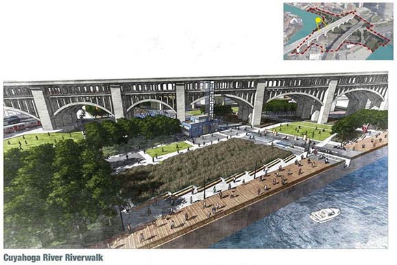
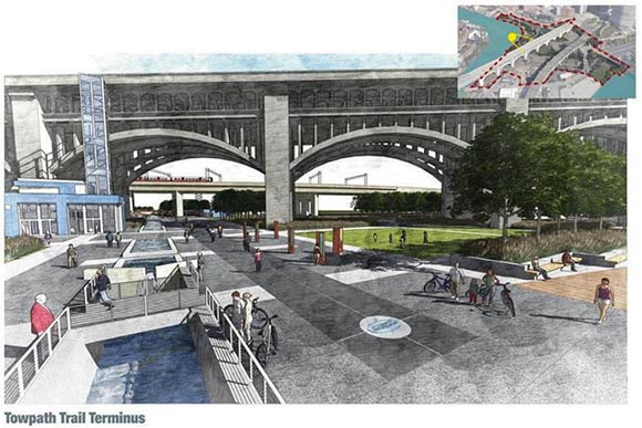
While team members described the plan as aspirational, not at all definitive and aimed at stimulating thought, proposed amenities include an interactive water installation, elevator access to the lower decks of the Detroit Superior Bridge, a riverside boardwalk, a life-size working model of a canal gate, a skating rink, lighting/placemaking elements, copious green space and a variety of programs and activities. The park will certainly house the terminus section of the popular Towpath Trail, which will finally reach Lake Erie.
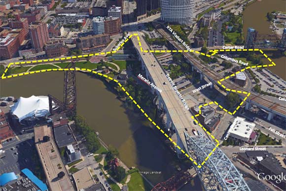
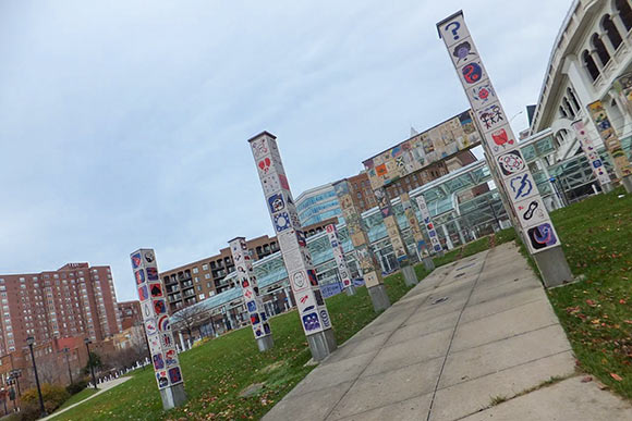
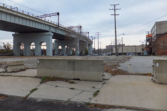
The irregularly shaped park will include a large section of area beneath the Veterans Memorial and RTA Viaduct Bridges, the Downtown Dog Park, the existing Settler's Landing Rapid Station and much of the green area that lines the East Bank of the Flats opposite the Nautica Entertainment Complex. The southern terminus of the associated trail will connect to the Scranton Flats via the Carter Road Bridge. The plan includes 165 parking spaces and also calls for a portion of Merwin Avenue to be removed.
Ninety percent of the associated 20 acres is already owned by public agencies including the city, the Greater Cleveland Regional Transit Authority, Cleveland Metroparks and the Northeast Ohio Regional Sewer District (NEORSD). Sherwin Williams and Kassouf Real Estate own the remaining 10 percent. While the Kassouf property is a parking lot and will likely remain as such, Donovan said, "We're talking to Sherwin Williams about a permanent easement over their property."
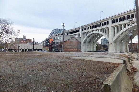
Currently, crumbling asphalt lots cover much of the associated publicly and privately owned acreage.
"Right now you go down there and it's a big asphalt space," said Donovan. "It's very hard. It's very unforgiving." It is also a place you do not notice until you purposefully look at it. Then the vast amount of available land in this incredibly unique and diverse urban pocket blooms before you with endless possibilities.
The next steps include formal site analysis with surveys and assessments of the topography, environmental status, infrastructure, utilities and soil; and the assemblage of funding sources. Donovan noted that the lion's share of the $54 million in funding for the six miles of trail from the Harvard Road trailhead north has been public (thus far $49 million has been secured) and that he sees the financial package for Canal Basin Park project coming together from different sources.
"We have milked that public cow as much as we can," said Donovan. "Now is the time for the private citizens, the corporations, the foundations to step forward and help us."
The City of Cleveland is the lead manager on the project. Partners include Canalway Partners, Cleveland Metroparks, Downtown Cleveland Alliance, Cuyahoga County and the Ohio & Erie Canalway.
The park will duly celebrate the historic significance of the location and terminus of the canal. Ironically, it will also act as a cosmopolitan urban gateway to the 101 miles of trail that will eventually span from Lake Erie to New Philadelphia, Ohio. That designation has far reaching implications for the region and towpath at large.
The team sees the park as an informational hub for the southern features on the towpath trail such as the St. Helena III boat rides in Canal Fulton or events at Lock 3 Akron. Cleveland also has a stalwart hospitality infrastructure for future park visitors, replete with copious lodging and entertainment options.
"We’re the funnel for visitors, those people going into this 101-mile regional park system," said Donovan, which per John Zayac, principal of The Project Group, is a very good thing on the heels of an event such as the Republican National Convention.
"A project like this can keep the momentum going," said Zayac.
Of course, access to the new park is an utmost priority. The team noted that it will be a strategic component in the city's goal of connecting neighborhoods to downtown.
"We have a goal of putting all Clevelanders within a 10-minute bike ride to the towpath and its connector trails," said the planning commission's Cantor, noting the park's close proximity to public housing complexes including Tremont Pointe Apartments, Riverview Towers and Lakeview Estates. "It also addresses the issue of waterfront access," he said, tagging both the lakefront and riverfront.
While the park itself will be new, the real estate it will occupy as part of the Cuyahoga corridor is incredibly storied and unique in its designation as a National Heritage Area, an American Byway, and an American Heritage River. Per Donovan, those components make the future park an enduring cultural touchstone.
"The towpath becomes our cinder spine; he railroad becomes our iron spine, the byway our asphalt spine," said Donovan. "This is the place where our history happened."


