Blazing trails: Metroparks wins federal money to build east side Towpath Trail equivalent
Metroparks' four new trail projects
The $950,000 grant money from the U.S. Department of Transportation advances four priority trail projects— collectively named the RAISE Cleveland Bicycle & Pedestrian Planning project.
The four projects are:
Slavic Village Downtown Connector Phase 2 North
Awarded funds for the full design of 2.2 miles of bicycle connection from E. 14th St. to the intersection of Broadway Ave. & Dille Ave. It will connect the Slavic Village neighborhood and completed Morgana Run Trail to the Towpath Trail through Cleveland Metroparks Washington and Ohio & Erie Canal reservations along with Downtown Cleveland. It will also connect to the all-purpose trail built as part of ODOT's Innerbelt Project along Orange Ave. that connects to E. 14th St. and on to the E. 9th St. Extension.
Morgana Run-Booth Ave. Extension
Awarded funds for the full design of a 0.8-mile all-purpose trail to link the completed Morgana Run Trail to the Mill Creek Falls area of Garfield Park Reservation. It will also connect to the Warner Road bike lanes and Mill Creek Connector Trail, as well as the future Slavic Village Downtown Connector via the Morgana Run Trail.
Iron Ct. to Opportunity Corridor
Awarded funds for feasibility-level planning a proposed 0.7-mile connection from the Western Terminus of Opportunity Corridor Trail at E. 55th to the Slavic Village Downtown Connector Trail near Iron Court/Broadway Area.
Euclid Creek Greenway Phase 2 North
Awarded funds for feasibility-level planning of a proposed two-mile bicycle connection between the lower Euclid Creek Reservation to its lakefront portion. The proposed connection would build on Cleveland Metroparks first phase of the Euclid Creek Greenway that will connect Euclid Creek Parkway to Euclid Avenue that will be constructed in 2022.
The Cleveland Metroparks and an influential coalition of planning agencies called the Cuyahoga Greenways Partners announced that they won $950,000 from the U.S. Department of Transportation for the planning and design of four small trail sections that make up 5.7 miles of trail and bicycle connections on Cleveland’s east side.
The projects were awarded federal funding through the Rebuilding American Infrastructure with Sustainability and Equity (RAISE) grants program and will support an overall $1.5 million planning project that leverages local funding from Cleveland Metroparks and the City of Cleveland.
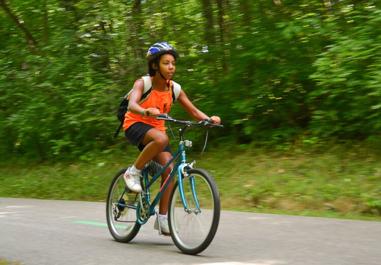
 Mill Creek FallsMetroparks officials promise the project will provide 80,000 people living near existing Metroparks—like Mill Creek Falls trail in the Garfield Park Reservation in the Union Miles neighborhood and the Euclid Creek Reservation, running from South Euclid to Euclid and East Cleveland—with additional options to access the trails by walking or by biking there.
The Cleveland Metroparks has an incredible year, dominating the headlines for finishing the towpath trail all the way to the lakefront and earned the parks system national recognition as one of the best parks in the country.
But now comes the follow up: A crucial, next chapter where arguably a less cohesive framework exists for an East side equivalent to the Towpath Trail. Yet, these four missing trail pieces promise to lay the groundwork for how the Metroparks plans to create a bike network between City of Cleveland parks, neighborhoods, and Metroparks reservations in an area that has not seen this kind of investment in generations.
Officials says they hope these connectors will have the same type of catalytic effect that the Towpath Trail extension to the Flats and the lakefront has brought to Cleveland’s near west side.
Once completed, this new endeavor will create a marked network that connects Cleveland’s southeast side to downtown through Cuyahoga Community College Metro campus and East 22nd Street, where bike lanes were added in recent years from Orange Avenue to the Euclid Avenue bike lanes.
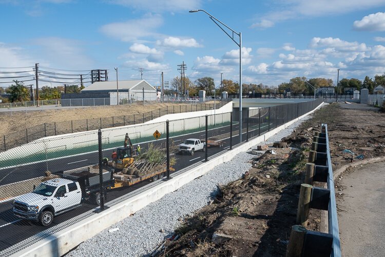 The Opportunity Corridor construction looking east toward E55th Street near completion in November 2021Two other important connections that this planning grant will make clear is the connection between the new bike trail running along Opportunity Corridor to downtown and an area between the Euclid Creek Reservation and the lakefront areas formerly known as Villa Angela Beach and Wildwood Park—now known as Euclid Creek North.
The trails must traverse busy roads like Euclid and Broadway Avenues, as well as through mix of industrial and residential areas that were sliced up by highways, railway underpasses, and changes in elevation. In other words, the type of Cleveland landscape that makes bicycling challenging to maneuver.
While officials with the Metroparks and Cuyahoga Greenway Partners don’t know where the exact alignment of the trails are—the planning grant will allow Metroparks officials to pinpoint the exact route—they do know what they hope to achieve — an east side equivalent to the Towpath Trail.
It will take shape without the dramatic rise and views of the industrial valley that the Towpath Trail brings, but the Slavic Village-to-downtown connector trail, the Opportunity Corridor-to-downtown connector, and the Euclid Creek Reservation-to-the Lakefront trail have their opportunities to get close to important landmarks and connect neighborhoods with downtown.
A sequel to a Cinderella story
One of the Metroparks’ key partners, Elaine Price of Cuyahoga Greenways Partners, notes that applying for the federal RAISE grant for the downtown connector was a calculated gamble on the part of the Metroparks because the City of Cleveland under mayor Frank Jackson had not prioritized the trail concept.
“Cleveland Metroparks was gutsy and stuck its neck out because three of the four trail segments are in the City of Cleveland and one is in Euclid,” says Price. “At the end of the day, the cities have to agree to move forward with the planning on these and have to want to find funding for implementation. Metroparks’ reputation [is on the line] and if Cleveland doesn’t really want to do this, it would put a strain on their ability to get future funds.”
 Euclid Creek ReservationSara Maier, senior planner at the Metroparks, says the park system won the highly competitive grant not solely on the strength of its vision, but also because the Cuyahoga Greenways Partners is a unique collaboration where planners like she and Price do the detail work and the heads of powerful organizations—like Northeast Ohio Areawide Coordinative Agency (NOACA) executive director Grace Gallucci and Cleveland city planning director Freddie Collier— agree on the projects that will be prioritized.
“It’s pretty amazing to get all those leaders to agree,” Maier observes. “It says, if we all agree and support this then they are important to the whole system.”
The Towpath is seen by many experts as the model for the “Downtown Connector” trail—a trail that will sometimes use city streets to scale rough terrain if it is going to provide a route from Slavic Village and points east like the Miles-Union neighborhood to downtown Cleveland.
“It’s going to make the neighborhood a lot more attractive,” says Slavic Village Development executive director Christopher Alvarado. “We’re an island. Once the downtown connector trail is built, we’ll be able to bike downtown in 20 minutes and not have to deal with traffic.”
Alvarado says the connector trails will also boost Slavic Village in its efforts to provide connectivity.
“When it comes to active living, we have vacant land that we’re turning into parks and development, like the Morgana Bluffs,” he says about the land adjacent to the Morgana Run trail where Trailside, a mix of 24 market rate and affordable homes, was built. “But we don’t have good connection to the east or north.”
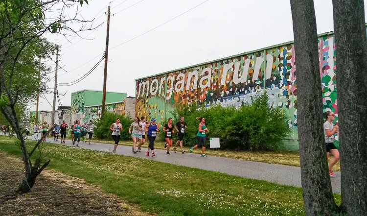 Slavic VillageTime for the east side of Cleveland to get its turn
The grant is needed to figure out how to thread the needle through industrial space, the origin of Cleveland steel making. Alvarado says visitors will be able to stand on the ground where steel was first made and rolled in a mill in Newburgh Heights—a site today where the tanker ships drop their bulk ore and limestone near Mill Creek Falls and Booth Avenue—where the trail may go.
“The big picture is to connect Morgana Run trail with Miles Park, the historic center of Union- Miles and the old Newburgh Township,” Alvarado explains. “It’s adjacent to the first iron foundry in Cleveland, the old rolling mills. We want to uncover not just the way-back history, but the more recent history. This is where [singer-songwriter] Tracy Chapman grew up, on East 91st Street and Miles Park.”
The second trail segment location that the planning grant will help determine is called Iron Court, a tricky spot named after an abandoned roadway near the East 34th Street Rapid Station. It will provide passage from the downtown connector to points east—including those accessed by the Opportunity Corridor and its off-road-adjacent bike trail.
The idea with the Iron Court connector, says Cuyahoga Greenways Partners’ coordinator and Cuyahoga County Planner Elaine Price, is to build up a multi-modal transportation system on the east side of Cleveland that combines on-road bike facilities and connected off-road paths. Multi modal systems could mean allowing e-bikes and scooters on the trails to assist households who don’t own cars, Price says, which can be as high as 25% of the population of Central neighborhood.
“If you live in Slavic Village and get a job at the Cleveland Clinic and don’t have a car, but if you had an eBike or scooter, this [grant can lead to] a micro-mobility network,” says Price. “You might have to be on-road for a little while with the Opportunity Corridor as a spine.”
Alvarado wants to press the case for the County to expand its investment in its bike share system into the east side of Cleveland.
“I’m pissed [that there is no bike share in Slavic Village],” he says. “All of the bike share stations are concentrated downtown, in University Circle and the Near West Side.”
While it took decades to finish the Towpath Trail, the expectation is for the Slavic Village Downtown Connector to begin construction in 2025.
“The idea is, we have green amenities that we can take advantage of,” says Alvarado, mentioning the green infrastructure mini parks that have been built near Fleet, Morgana Run and the future path. “So, not only folks living in dense city neighborhoods will no longer have to be beholden to private vehicles.”
 Euclid Creek ReservationA big tent to RAISE this up
Metroparks’ Maier, who wrote the winning grant, says the park systems shares Alvarado’s vision.
“Trails are transportation corridors that can get people through their neighborhoods,” she comments. “There’s also a lot of transit connectivity that can happen with trails. This is creating a safer first-mile and last-mile connection [from a transit stop]. This is a transportation project that functions in the day-to-day to give people a space that’s safe.”
For example, Euclid Avenue’s run in the City of Euclid, Maier says, has the second-highest bus ridership in RTA’s system. It will be the focus of a third piece of trail planning, starting at the intersection of Euclid Avenue and Chardon Road.
The Metroparks took possession of an 11-acre now-vacant property that abuts he Euclid-Chardon intersection, and the proposal calls for vacating an extraneous portion of Chardon Road running through the property, re-claim the land for park space, and build a bike trail that will lead from Euclid to Highland Road.
Once the tail is built across that wide expanse, it will connect to the entrance of the Euclid Creek Reservation, where there’s a bike path that runs all the way to Highland Heights and South Euclid.
The ultimate goal, says Euclid planning director Allison Lukacsy-Love, is to provide a safe bike connection from the Euclid Creek Reservation South to the same Metroparks “in name only” at the lakefront along a north-south road. Many of the industrial roads(with dense residential streets connected) and are too narrow to paint in a bike lane, so the city and Metroparks will use grant funds to study alternative routes.
“The Metroparks have shown preliminary plans that allows for that trail to ‘hop over’ Euclid Avenue, which is not insignificant,” says Lukacsy-Love. “This makes good on the (narrative that) the lake is not just for the fortunate few who have property on it.”
Finding the best north-south route has been challenging, she adds, and will take a couple of years to unfold. “There are opportunities to go off-road on Euclid that aren’t just sidewalks. We’re looking at a recreation trail off Euclid at this time that doesn’t have a direct link to this trail.”
Meanwhile, a culture shift for people to see biking as a transportation mode needs to continue growing, says Lukacsy-Love. The recently completed lakefront trail in Euclid may help change some minds that Euclid is open to more biking trails.
“There are definitely real opportunities for having people think differently about how to commute,” she notes. “Right now, the majority of Euclid residents see walking and biking on a recreation level. We do have a population who relies on those modes for getting around. We want this to be something that families, not just confident cyclists, will use.”
The ability to get things done is the reputation that the Cleveland Metroparks has cultivated, and that could be the difference between a nice plan and a real, catalytic project, says Price.
“I helped get the letters of support for these projects [earlier this year],” Price recalls. “In a letter, City Club of Cleveland executive director Dan Multhrop summed it up, saying, ‘If you want to get something done in Northeast Ohio, ask the Metroparks.’”
